The Streetcar Suburb and the Shape of Early City Growth
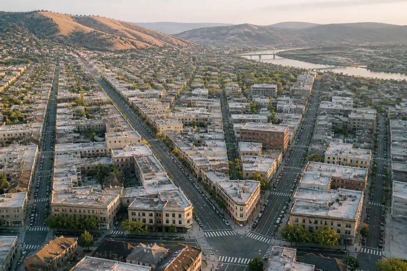
Streetcar suburb growth tied homes to fixed routes, shaping residential districts in recognizable bands and corridors that still help explain city form.
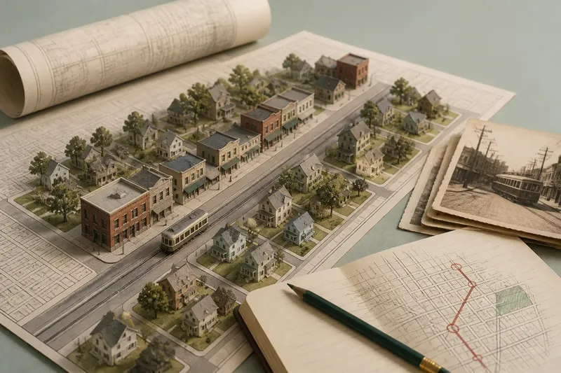
Streetcar suburb growth is easiest to see from a moving car window: a busy commercial street runs outward from an older center, then gives way to houses on quieter cross streets. The route did more than carry passengers. It helped decide where homes clustered, where shops gathered, and how far a residential district could extend while remaining connected to daily work.
To read this pattern, follow the line outward rather than treating the suburb as a separate place that appeared all at once. The route, its stops, and the streets branching from it formed a linked sequence of development. That sequence is the central clue to how early city growth took shape.
Why did streetcar routes shape residential growth?
Before widespread private car use, a fixed transit line offered a dependable connection between a home district and the city’s workplaces, shops, and civic destinations. A streetcar route made some locations easier to reach than others. Land close to the line, especially near a stop, could attract residents who wanted access without living on the busiest street itself.
That arrangement created a practical tradeoff. Homes set directly along a route had convenient access but also faced passing traffic and commercial activity. A block or two away, residents could use the same line while living on a quieter street. The result was often a corridor of shops and services framed by residential blocks that extended sideways from it.
Routes also made growth directional. A city could spread along an existing line or extend service toward a new district. Where a line ended, development might thin out; where routes met or branched, a stronger focus for commerce and neighborhood activity could emerge. These were tendencies, not a single formula. Local street layouts, terrain, land ownership, and the timing of construction all affected the form.
What does a streetcar suburb look like on the ground?
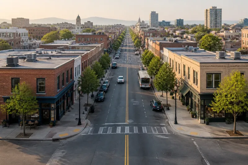
Look for a change in intensity as you move away from a route. The main street may carry shops, apartments, or larger buildings, while nearby blocks hold detached houses, duplexes, or small apartment buildings. The shift is often gradual rather than marked by a clean boundary. A commercial corner can sit beside a residential street, with everyday uses mixed close together.
Street widths and block patterns offer further clues. The route may follow a direct street that connects to the center, while side streets provide access to homes. Some districts have compact blocks and frequent intersections; others spread across longer blocks or bend around local terrain. The essential pattern is not a particular street grid. It is the relationship between the transit corridor and residential areas within an easy walk of it.
Older buildings can make the relationship especially legible. A small shop near a stop may face the route, while houses behind it turn toward quieter streets. Later changes can blur the original arrangement: a bus may replace the streetcar, a road may carry more traffic, or shops may move to another center. The underlying street network can still preserve the older corridor-and-neighborhood pattern.
How can you trace the pattern over a week?
A short, repeatable observation routine works better than trying to interpret an entire city in one outing. Choose a corridor that appears to connect an older center with a residential district. Use a current street map, a transit map, and, if available, a historic map or local archive image. The goal is to compare the route with the shape of nearby development, not to assume that every visible feature dates from the streetcar era.
- On the first day, locate the corridor. Mark the older center, the route’s outward direction, and any place where another major street or transit line meets it.
- On the second day, note likely stop areas. Look for small commercial clusters, widened corners, or transit shelters, then check whether the location appears on older maps.
- On the third day, walk one side street. Record how quickly shops give way to homes and whether the residential blocks remain connected to the main corridor.
- On the fourth day, compare another branch. A second route or parallel street can show whether growth followed a single line or spread through several connected corridors.
- On the fifth day, check the district’s outer edge. Observe where the continuous residential fabric becomes less dense, meets open land, or joins another center.
- On the sixth day, compare map layers. Note which streets, building clusters, and transit connections recur across present-day and historic maps.
- On the seventh day, write a short route-to-homes account. Describe what the corridor appears to connect, where activity clusters, and which parts of the pattern remain uncertain.
Say you are tracing a fictional line from an old downtown toward a residential district. You notice a row of shops beside a likely former stop, then houses on the next streets, with another cluster near a branch route. Comparing that pattern with a historic map could support the interpretation that transit helped organize growth; if the map shows the shops appeared much later, you would revise the account rather than treating them as evidence of the original layout.
Which clues help separate route influence from coincidence?
A single shop or straight street is not enough to identify a streetcar suburb. Look for several clues that reinforce one another: a route linking the area to an older center, repeated commercial clusters at plausible stopping points, and residential streets that connect those clusters to surrounding homes. Historic maps can help establish sequence, while present-day observation shows what remains in use.
Pay attention to what the evidence cannot tell you. A current transit route may follow an older streetcar corridor without preserving its original service pattern. A commercial strip may have grown around a road rather than rail. Building styles can also be misleading because later construction may replace the first homes while keeping the street arrangement intact.
For a careful reading, separate three observations in your notes: what you can see now, what a map records, and what you infer about the connection between them. This simple distinction keeps the interpretation grounded. If the route’s history is unclear, local transit archives, municipal map collections, or a historical society may offer a better record than the street scene alone.
What questions help interpret a streetcar suburb?
Did every streetcar stop become a commercial center?
No. Some stops served nearby homes without supporting a visible shop cluster, while other commercial centers grew for reasons beyond transit access. Treat stops as places to investigate, not as proof that a business district must have formed.
Why are some homes set back from the main route?
Side streets offered access to transit while separating homes from the activity and movement on the corridor. The arrangement also let residential development spread across a wider area than the route-facing parcels alone.
Can a streetcar suburb still be recognized after the streetcar disappears?
Often, the corridor and the connected residential blocks remain visible even if the original vehicles and tracks are gone. Historic maps and street-level land use can help distinguish that inherited pattern from later development.
Did streetcar suburbs all have the same layout?
No. The route-to-district relationship could recur, but terrain, existing roads, land divisions, and local building choices produced different forms. Read each corridor in its own setting instead of expecting a standard plan.
What should you look for at the district’s edge?
As the continuous streetscape thins, note whether the pattern ends abruptly or fades into scattered homes and open land. The transition may reflect the reach of an earlier transit line, but it may also follow a physical obstacle, a municipal boundary, or a later change in land use. The edge is useful because it shows where the connected residential fabric loses its continuity.
Then compare that edge with the route itself. If homes and small centers line up along the corridor farther out than they spread sideways, growth may have followed the transit connection more strongly than it filled the surrounding area. If the district extends broadly beyond the route, other forces may have helped shape its expansion.
Streetcar suburb growth is not simply a story of homes appearing beside tracks. It is a pattern of access and distance: a route connects the city to new residential ground, activity gathers at selected points, and quieter streets carry the district outward from the line. When you follow that sequence on a map and on foot, an old transit corridor becomes a guide to the city’s early growth—and to the neighborhood structure still visible around it.