A City Square, Read from Its Entrances
Read a city square through its entrances: notice how openings, paths, and street connections shape the routes people can take across public space.
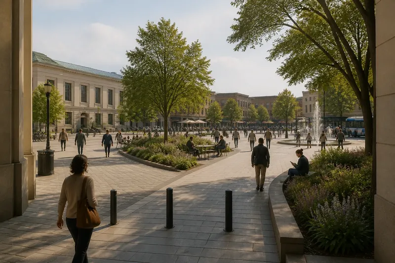
You enter the city square from a narrow side street, but the broad opening across the plaza seems to pull you toward the market district. A city square’s entrances do more than let people in: their positions help decide whether visitors cross, skirt, pause, or turn back. Look closely at those openings, and the square begins to read like a map of possible journeys.
What counts as an entrance to a city square?
Start with every place where a pedestrian route meets the square. Some entrances are obvious gaps between buildings or breaks in a low wall. Others are less formal: a wide sidewalk that continues into the plaza, a path through a planted edge, or steps connecting a higher street to the square below.
Do not assume that the most impressive entrance is the one people use most. A monumental arch may frame the main view, while a modest opening near a bus stop offers the easiest everyday access. Notice width, visibility, surface, shade, and whether the route feels continuous from sidewalk to square.
A useful distinction is between an opening and a usable approach. A gap may be physically open yet awkward to reach because a curb, planter, parked vehicle, or busy turning lane interrupts the route. For this observation, stay on public paths and follow posted signs; do not cross barriers or enter restricted areas.
How do the openings shape a route across the square?
First, stand just outside an entrance and look toward the other visible openings. Imagine a line joining each pair. Then walk a permitted route and see whether that line remains practical. A fountain, stage, seating cluster, tree grove, or change in paving may bend the path, even when the far entrance is easy to see.
Watch for three broad route patterns. A square with entrances opposite one another may invite a direct crossing. Openings along one edge can encourage movement parallel to the street rather than through the space. Several entrances around the perimeter may create a network of shorter choices, with visitors weaving between destinations.
Those patterns are not rules. The location of a café, transit stop, public building, or shade can pull people toward one side. So can a traffic signal that makes one approach easier than another. Compare the route people appear to choose with the route the layout seems to offer; the difference is often revealing.
What should you notice as people arrive and leave?
Observe from a spot that does not block anyone. Notice where people enter, where they head next, and whether they pause to orient themselves. A person who steps in, looks across the square, and changes direction may be responding to an unclear route. Someone who keeps walking without slowing may have a familiar destination or a clear path.
Look for small signs of friction: walkers bunching at a narrow opening, people detouring around a planter, or visitors choosing a longer path to avoid steps. Also note signs of welcome, such as a smooth connection from the sidewalk, a visible path through trees, or a bench near an entrance for someone who wants to rest before continuing.
One visit cannot tell you why every person chose a particular route. Treat what you see as a set of clues, not a verdict about the square. Time of day, weather, an event, or a temporary closure can change how people move.
How can a hypothetical walk reveal a square’s layout?
Say you arrive at an invented square called Harbor Green from a library on its west side. Its west entrance opens onto a broad paved walk; a narrow gate sits to the north; and a diagonal path leads toward a transit stop at the southeast corner. In the center, a planted bed obscures part of the diagonal route.
You first walk in from the library and face the transit stop. The bed blocks the direct line, so you follow the edge of the planting and pass a seating area. From there, the diagonal path becomes visible, and you continue to the southeast exit. On the return, you notice that the north gate provides a shorter link to a grocery street, but its narrow opening is easy to miss from inside the square.
The result is a simple reading, not a claim about real visitors: Harbor Green offers a clear west-to-southeast journey once you find the path, while the northern connection is less visible. The walk also shows how one central feature can shape a route without closing it. If you were describing this square, you could name both the direct connection and the less conspicuous alternative.
Which questions help you read a city square from its entrances?
How many entrances should I count?
Count the pedestrian openings you can identify around the square, including informal-looking sidewalk connections. Keep vehicle access separate unless pedestrians can use it as a legitimate route.
Should I treat steps as an entrance?
Yes, record them as an approach, then note whether another step-free route reaches the same part of the square. This gives a fuller picture of the choices available without assuming that one path works for everyone.
What if I cannot see the far entrance?
Walk only along public paths to a safe viewpoint, or note that the opening is screened from your starting point. Limited visibility is itself useful: it can make a route harder to understand before someone enters.
Can a square have no clear main entrance?
Yes. If several edges connect directly to sidewalks and no opening dominates, the square may function as an extension of the surrounding walking network. Describe the connections you can observe rather than assigning a ceremonial “front.”
How can you record your observations without overcomplicating them?
A quick sketch is often more useful than a list of impressions. Draw the square as a rough shape, mark each entrance, and add nearby destinations such as a transit stop, library, or shopping street. Use arrows for routes you can follow and a dotted line where a feature interrupts your view or path.
- Mark which edges connect directly to ordinary sidewalks.
- Note whether each opening is broad, narrow, visible, or screened.
- Trace one route between entrances and record where it bends.
- Identify features that attract, redirect, or slow movement.
- Mark a step-free approach when you can identify one.
- Write down the time and any unusual conditions, such as a market or temporary closure.
Keep the notes descriptive. “The west opening faces the library, and the central beds hide the southeast path” is more useful than “the square is confusing.” Specific observations let another reader understand what you saw and decide whether the same route would work for their visit.
What can entrances tell you about a square’s role?
A square with routes linking several busy destinations may work as a passage as well as a place to sit or gather. A square whose entrances lead mainly to nearby civic buildings may feel more like a shared forecourt. Many spaces do both, and their use can shift with events, weather, and daily routines.
Pay attention to where entrances lead beyond the square. A visible connection to a transit stop can make the plaza part of a longer trip; a path toward shops may draw people through on errands. These links help explain why one opening matters more than another, even when both look similar inside the square.
Reading a city square through its entrances is a practical way to understand its public life without guessing at its history or design intentions. Follow the openings, compare the routes they make possible, and note where the space invites a detour or a pause. The most useful observation may be a small one: the entrance you almost missed can reveal a connection the square quietly provides.